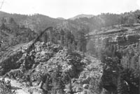
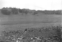
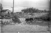
1. Near Manitou, Lower Ute Pass.
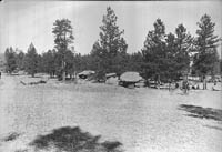
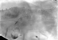
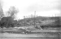
5. Same - Florissant, looking east
.


Professor George Stone's guide book manuscripts did not go beyond these early drafts. He was matching his photographs with parts of the text, but this project was not completed. Three sets of numbers were used (including two sets of Roman numerals), and we have included these exactly as he left them. Where possible, numbers are hyperlinked to the manuscript pages.
|
|
1. Near Manitou, Lower Ute Pass. |
|
|
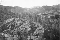
2. Near Manitou, Lower Ute Pass. |
|
|
3. Titania's Tables - Manitou Park, 1 1/2 mile N.W. from hotel. [LXVII-1] |
|
|
4. Blue Mountain from 1/4 mile southwest of Florissant. [XLVIII-1] |
|
|
5. Same - Florissant, looking east . |
|
|
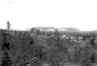
6. Florissant, looking east. |
|
|
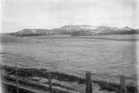
7. Pikes Peak from 1 mile west of Divide - fore-ground is the plain of Hayden gravel, the intermediate benches is Raspberry Butte. [XLI-1] |
|
|
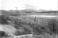
8. Same as #7, but 1/4 mile further away. [XLI-2] |
|
|
9. Sutherland Creek junction with the Fountain Creek. [VIII-1] |
|
|
10. Sutherland Creek junction with Fountain Creek - near Manitou - Newton Lumber Co. at left. [VIII-2] |
|
11. West of Colorado City, looking southwest. |
|
12. Red Rock Canyon - looking south from the Colorado Midland Railway from a point 1/2 mile west of Colorado City. [V] |
|
13. Ute Pass - looking northeastward across the Ute Pass from a point near Rainbow Falls. [XIII-3] |
|
14. View of Garden of the Gods from Colorado Midland Railway, 1/2 mile west of Colorado City (Fountain formation). [IV] |
|
15. One half mile southwest Colorado City looking at the rough ridge in front of the Dakota hogback, Fountain Creek flows across middle of view (left to right). The slope of the Rampart Range appears in the left distance. [I] |
|
16. Boulders, Ute Pass (coarse grained red granite on bottom and finer grain of whiter color on top). [XX1] |
|
17. View looking westward across Ute Pass, Hurricane Canyon and Pikes Peak are in right distance. [XX] |
|
18. Near Hurricane Canyon - Rampart Range Road panorama. |
|
19. Panorama, near Crystola - Rampart Range Road. |
|
20. View from Cascade Station across Ute Pass toward Rampart Range. [XXV] |
| Stone Guide Main Page | Glass Plate Negatives: |
| 1-20, | 21-40, | 41-60, | 61-80, | 81-100, | 101-120, | 121-140, | 141-160, | 161-180, | 181-200, |
| 201-220, | 221-240, | 241-260, | 261-280, | 281-300, | 301-320, | 321-340, | 341-360, | 361-380, | 381-385. |
last updated 8-29-01, ca